
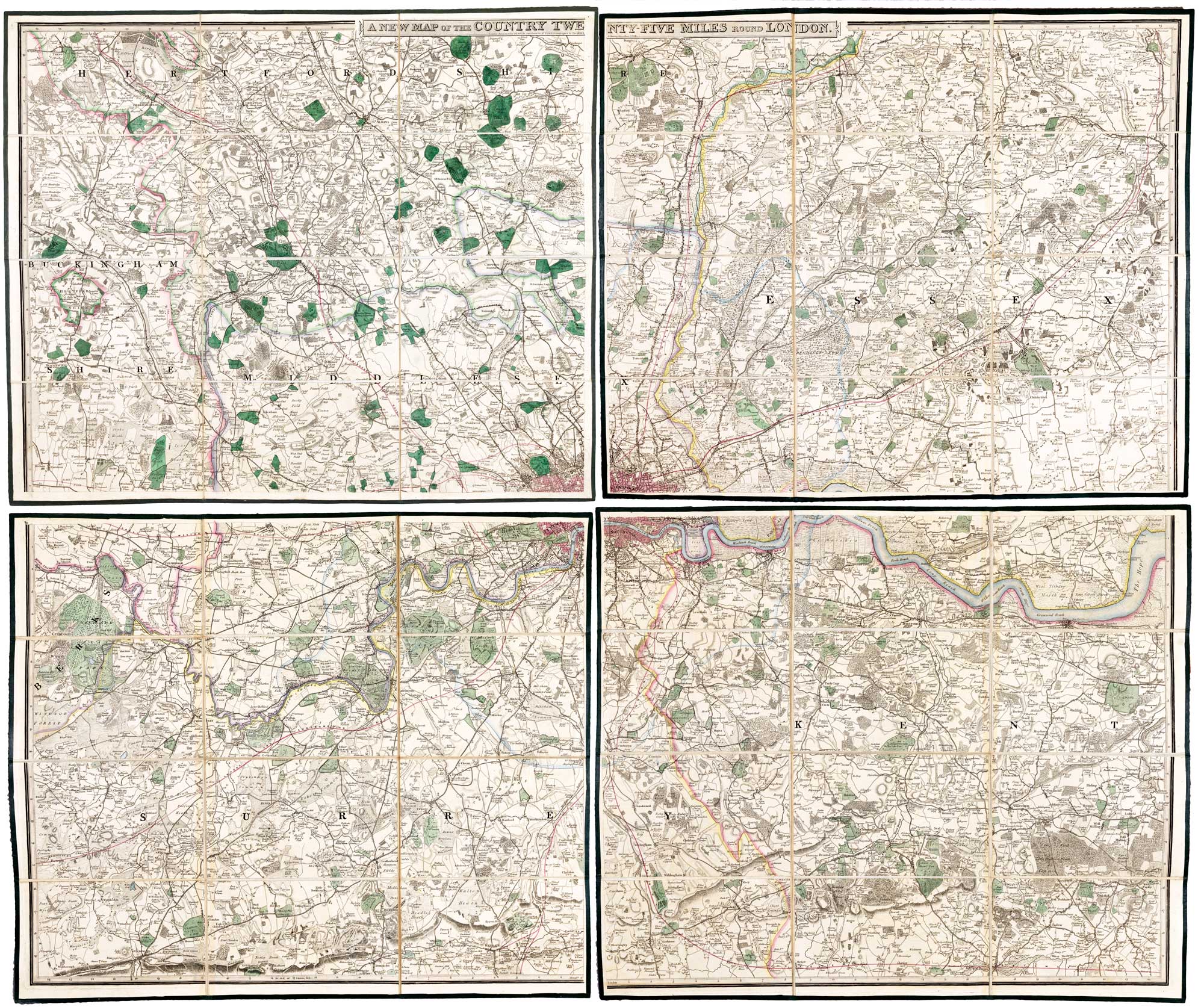
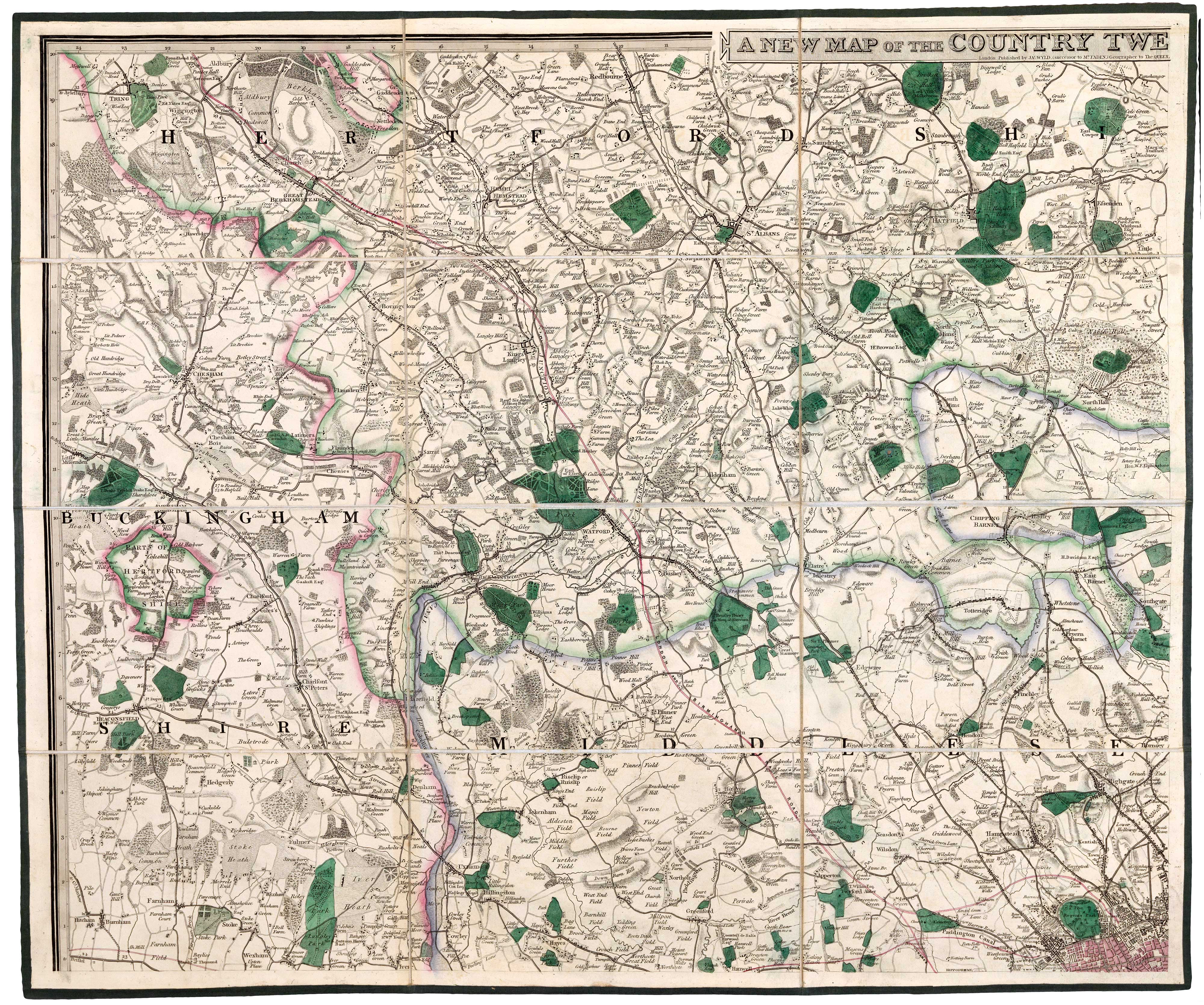
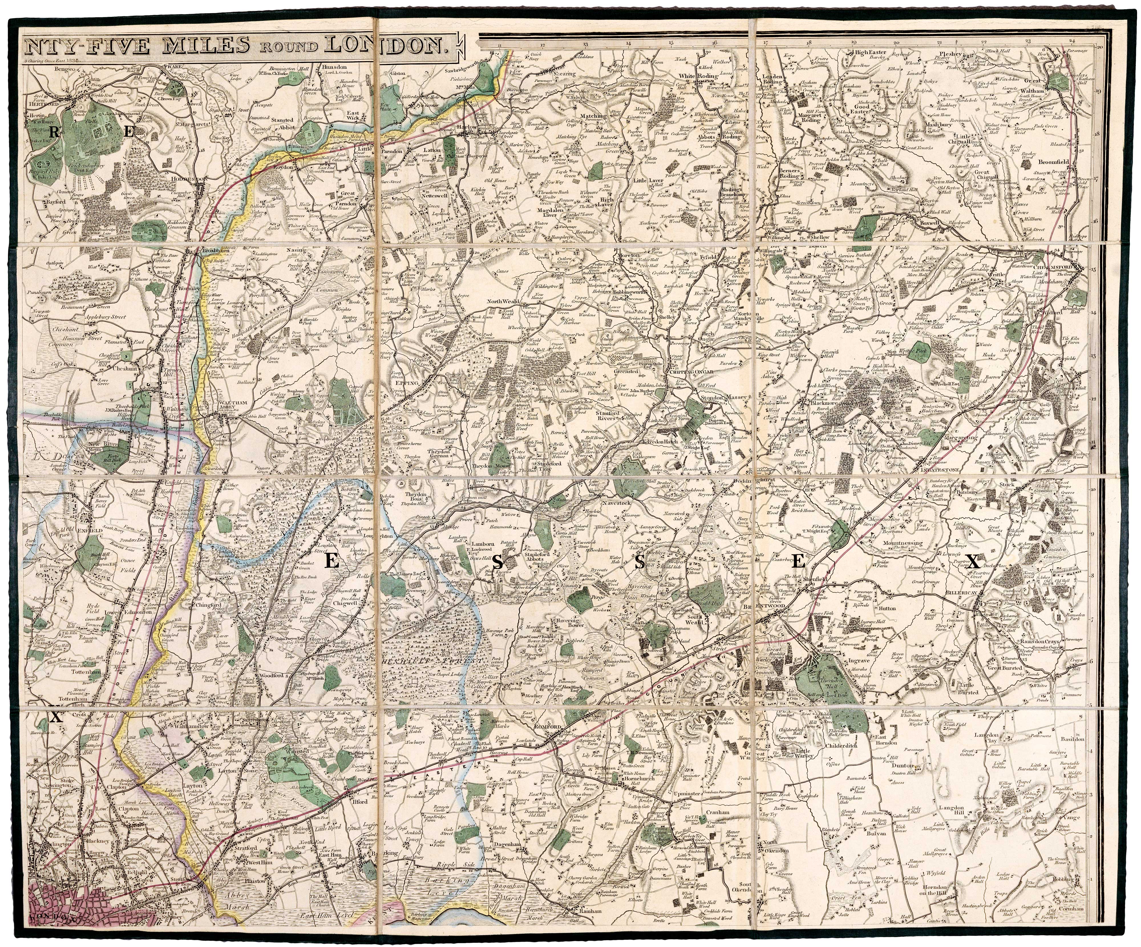
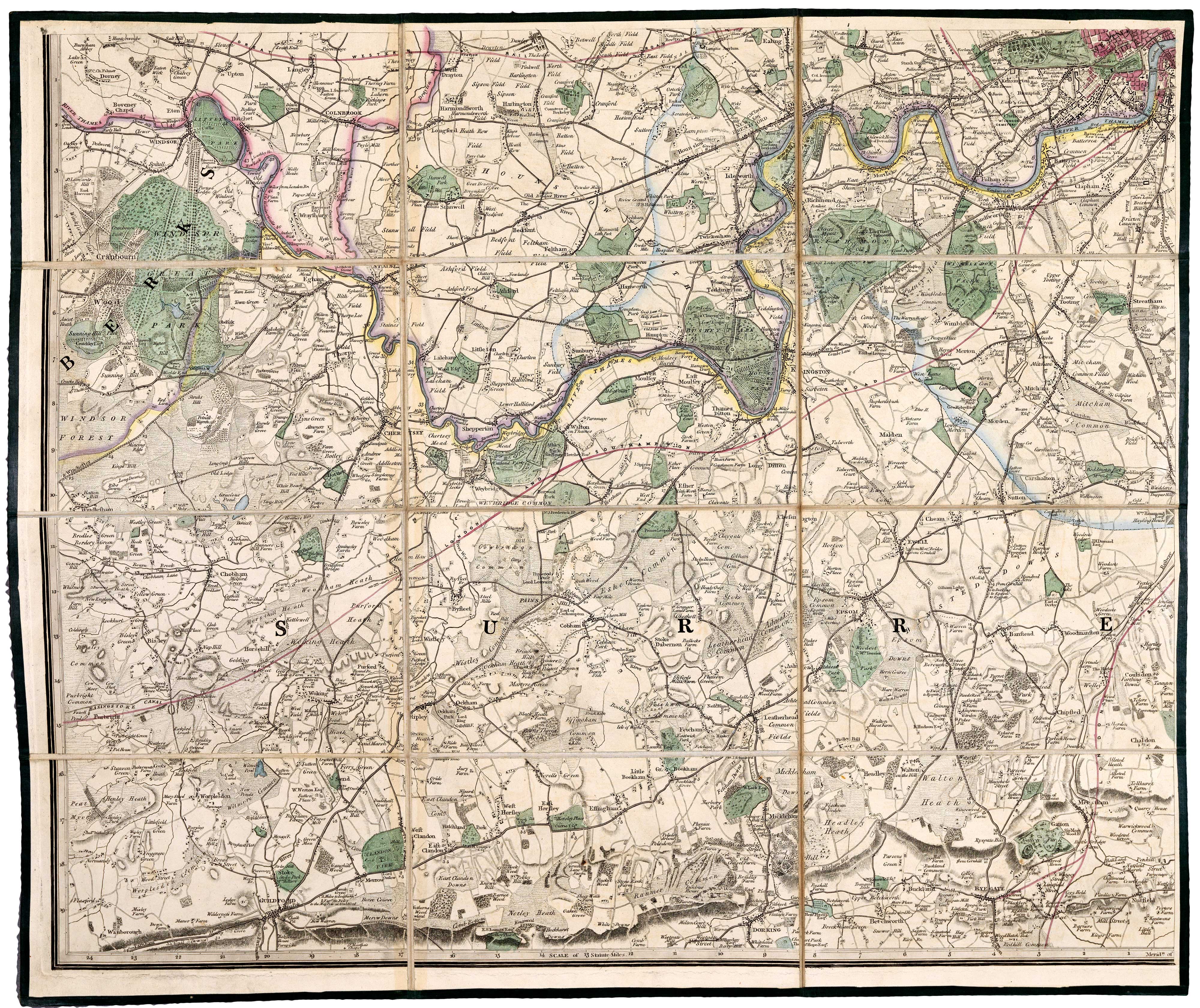
Detailed map of the environs of early Victorian London
FADEN, William.
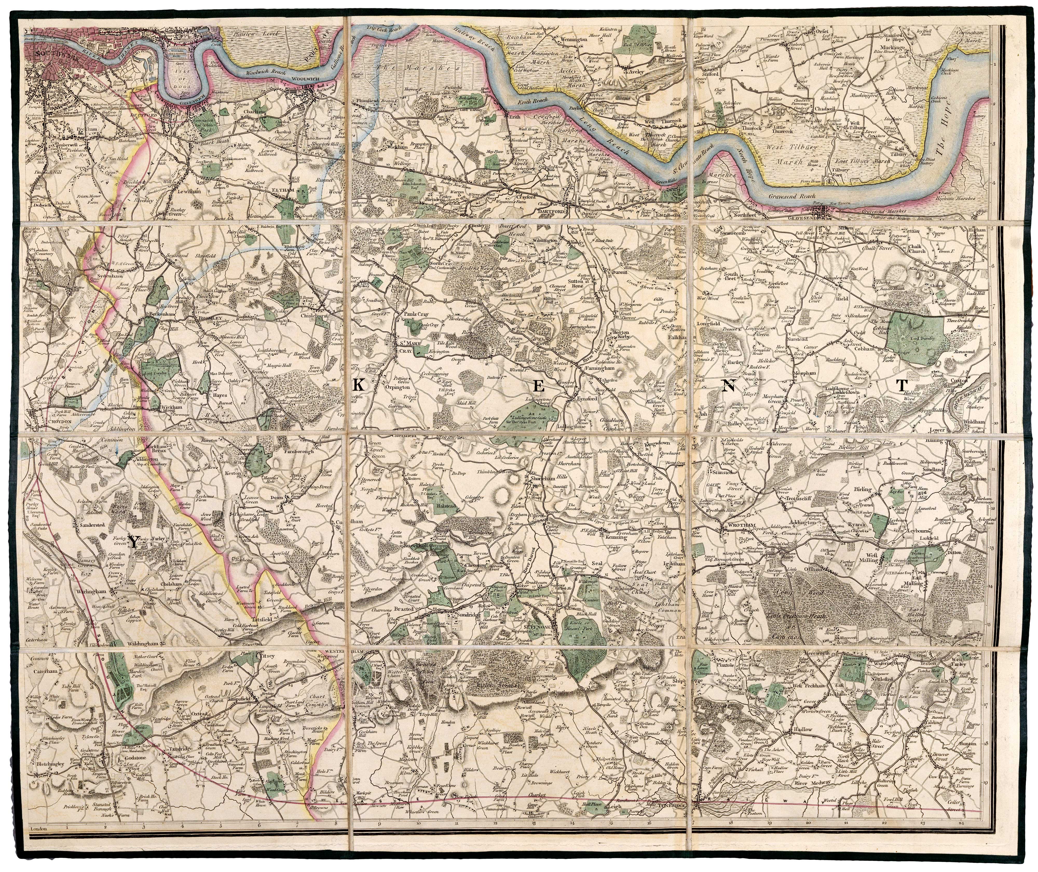
A New Map of the Country Twenty-five Miles Round London.
London: James Wyld, 1838. Original colour. Dissected and laid on linen in four sections, each 540 x 650mm, folded into original publisher's slipcase. Total if joined approx 1080 x 1300mm.
A large and detailed map, extending to Amersham in the west, clockwise to Hemel Hempstead, Ware, Chelmsford, Billericay, Tunbridge, Bletchingly, Reigate, Dorking, Guildford, Windsor and Beaconsfield.
Originally published in 1788, this map was updated for about a century, the last issued being c.1880. This edition was the first to mark railways.
HOWGEGO: 188, state 10a.
Stock ID : 19686
£750
£750

Detailed map of the environs of early Victorian London
FADEN, William.
A New Map of the Country Twenty-five Miles Round London.
London: James Wyld, 1838. Original colour. Dissected and laid on linen in four sections, each 540 x 650mm, folded into original publisher's slipcase. Total if joined approx 1080 x 1300mm.
A large and detailed map, extending to Amersham in the west, clockwise to Hemel Hempstead, Ware, Chelmsford, Billericay, Tunbridge, Bletchingly, Reigate, Dorking, Guildford, Windsor and Beaconsfield.
Originally published in 1788, this map was updated for about a century, the last issued being c.1880. This edition was the first to mark railways.
HOWGEGO: 188, state 10a.
Stock ID : 19686
£750
£750


Altea Antique Maps & Charts
Altea Gallery Ltd, 35 St George Street
London
W1S 2FN
United Kingdom
Tel: +44 20 7491 0010
info@alteagallery.com
Sitemap :

