
One of the earliest printed maps of North America
BORDONE, Benedetto.
Terra de Lavoratore. [&] Norbegia.
Venice, c.1540. Woodcut, printed area 80 x 145mm, set in a page of Italian text. Second woodcut, 140 x 145mm, on reverse.
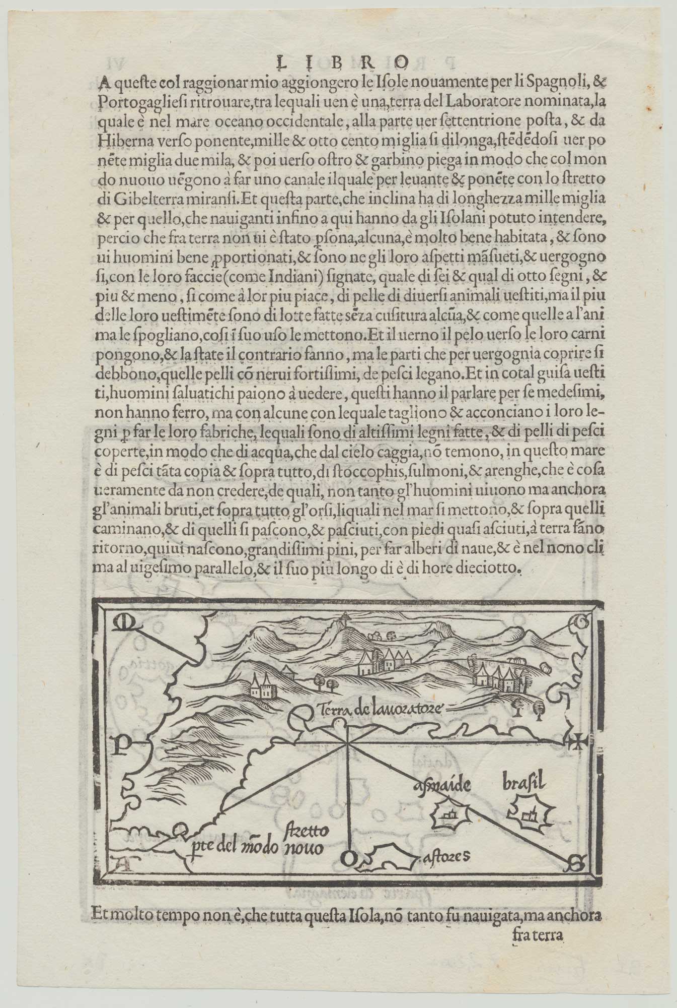
An early miniature map of North America, based on the discoveries of João Fernandés, published in the First Book of the 'Libro di Benedetto Bordone', better known as his 'Isolario'. The continent is given the name of 'Terra de Lavatore' after Fernandés's nickname ('farm labourer' in Portuguese), a term now limited to Labrador in Canada. A label 'Stretto' marks a strait between 'Terra de Lavatore' and 'Pte del Modo Nuovo' (at the time 'New World' only referred to South America), the hoped-for route to China. Also marked are the Azores (Fernandés's birthplace) and the mythical islands of Brazil and Asmaide.
At first glance the 'island' more resembles Greenland (also visited by Fernandés); however, on the 'Isolario's' world map, 'Terra del Laboratore' is obviously North America, being located mostly on or below the same latitude as the British Isles and above South America.
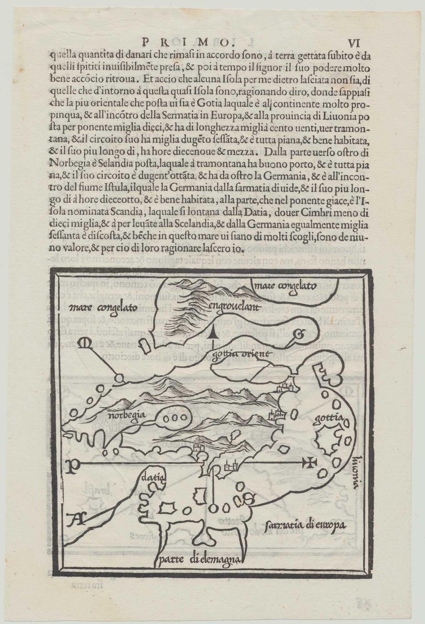
On the reverse is a map of Scandinavia and the Baltic. Despite the six editions between 1528-1562 these maps seldom appear on the market.
BURDEN 8, edition of c.1540; GINSBURG: Scandinavia 7.,EC14
Stock ID : 20065
SOLD
To see similar items click here

One of the earliest printed maps of North America
BORDONE, Benedetto.
Terra de Lavoratore. [&] Norbegia.
Venice, c.1540. Woodcut, printed area 80 x 145mm, set in a page of Italian text. Second woodcut, 140 x 145mm, on reverse.
An early miniature map of North America, based on the discoveries of João Fernandés, published in the First Book of the 'Libro di Benedetto Bordone', better known as his 'Isolario'. The continent is given the name of 'Terra de Lavatore' after Fernandés's nickname ('farm labourer' in Portuguese), a term now limited to Labrador in Canada. A label 'Stretto' marks a strait between 'Terra de Lavatore' and 'Pte del Modo Nuovo' (at the time 'New World' only referred to South America), the hoped-for route to China. Also marked are the Azores (Fernandés's birthplace) and the mythical islands of Brazil and Asmaide.
At first glance the 'island' more resembles Greenland (also visited by Fernandés); however, on the 'Isolario's' world map, 'Terra del Laboratore' is obviously North America, being located mostly on or below the same latitude as the British Isles and above South America.
On the reverse is a map of Scandinavia and the Baltic. Despite the six editions between 1528-1562 these maps seldom appear on the market.
BURDEN 8, edition of c.1540; GINSBURG: Scandinavia 7.,EC14
Stock ID : 20065
SOLD
To see similar items click here


Altea Antique Maps & Charts
Altea Gallery Ltd, 35 St George Street
London
W1S 2FN
United Kingdom
Tel: +44 20 7491 0010
info@alteagallery.com
Sitemap :

