

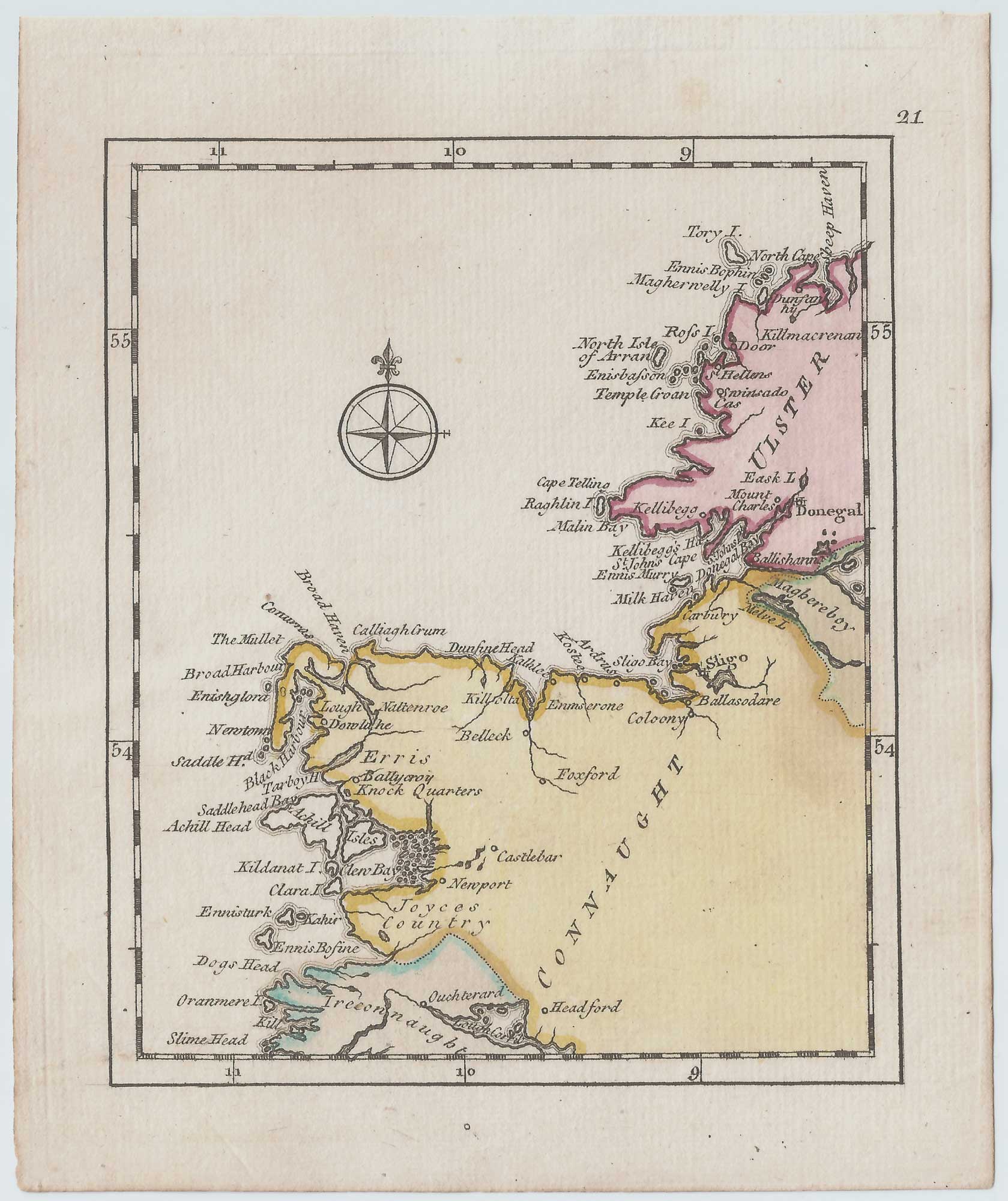


An 18th century map of Ireland on four sheets
DURY, Andrew.
[Ireland.]
London: Dury, 1764. Fine original colour. Four sheets, each 140 x 115mm.
An unusual set of miniature maps of Ireland, with many names of coastal towns but little detail inland. It was published in Dury's rare pocket atlas, 'A Collection of Plans of the Principal Cities of Great Britain & Ireland, with Maps of the Coast of the Said Kingdoms, Drawn from the most Accurate Surveys, In Particular those taken by the late Mr. J. Rocque, Topographer to His Majesty'. This was designed as a companion to Dury's 'Universal Pocket Atlas'.
Stock ID : 21445
SOLD
To see similar items click here
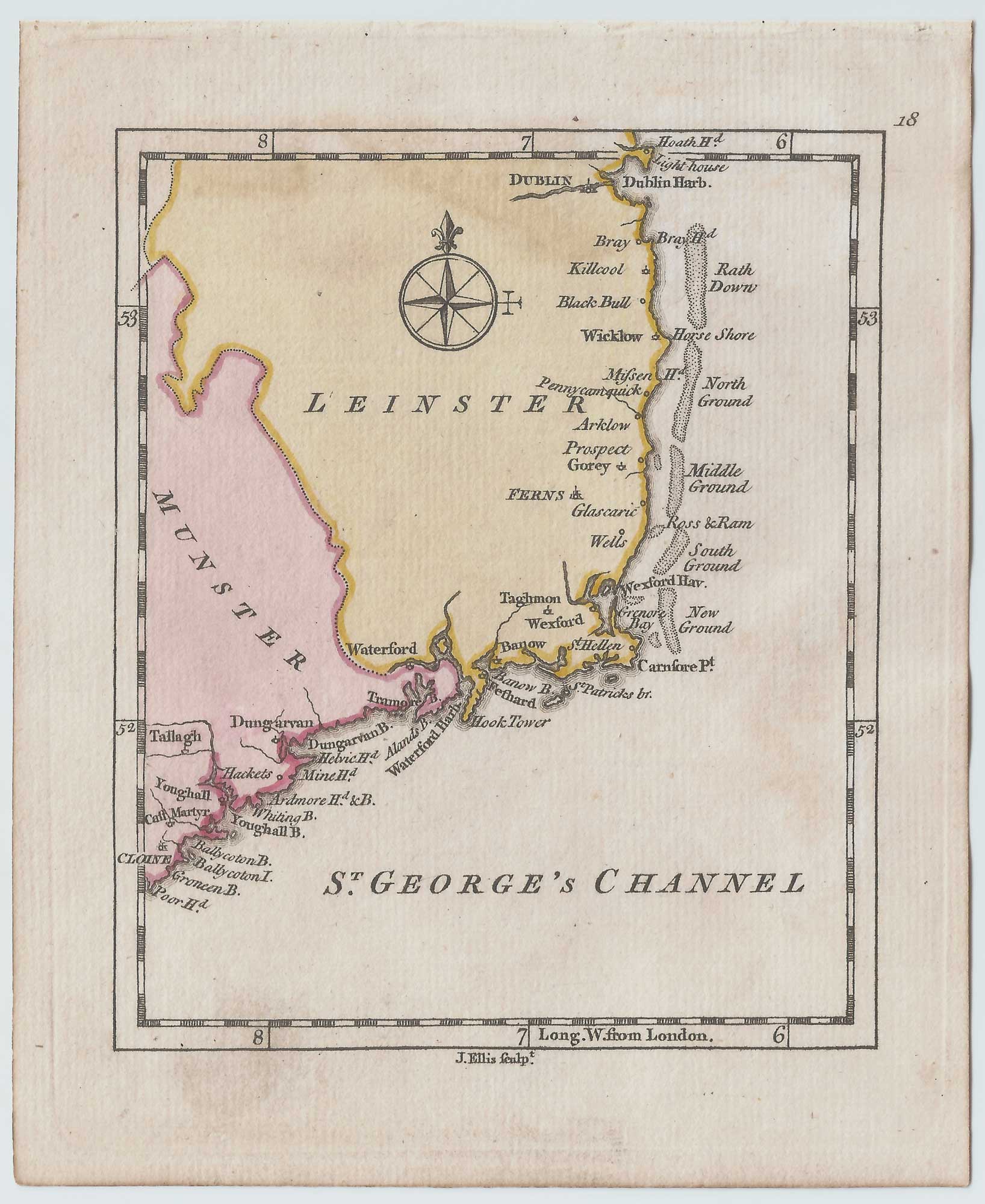


Altea Antique Maps & Charts
Altea Gallery Ltd, 35 St George Street
London
W1S 2FN
United Kingdom
Tel: +44 20 7491 0010
info@alteagallery.com
Sitemap :

