
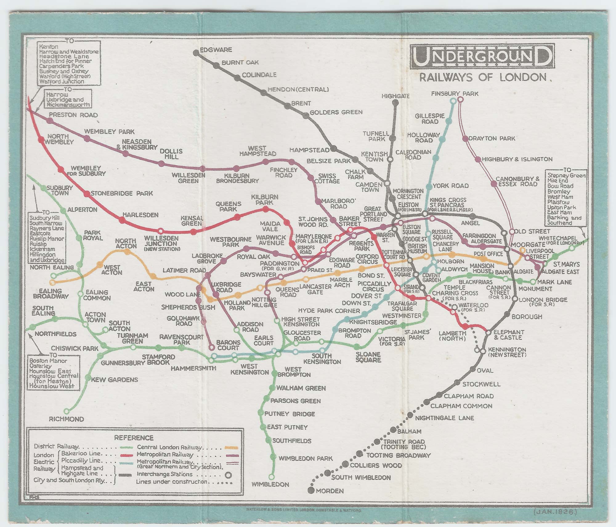
A pre-Beck map of the London Underground
STINGEMORE, Frederick H.
Underground Railways of London.
London: Commercial Manager's Office, London Underground, 1926. Colour-printed map on card, 125 x 150mm.
A little wear to edges and folds.
An early issue of Stingemore's pocket map of the London Underground, using his idea of expanding the central area of the map for ease of reading. On the map the Piccadilly Line only runs between Hammersmith & Finsbury Park and the Northern Line ended at Highgate (although this station is now Archway).
Among the 'lost' stations shown are 'Down Street' & 'Brompton Road' on the Piccadilly Line (both used as government shelters during WWII), 'British Museum' on the Central Line, and 'Praed Street' and 'Bishops Road', both of which have been incorporated into Paddington Station. 'Arsenal' is still called 'Gillespie Road'. The Central Line is coloured orange. The Thames is shown, returned after being omitted for the previous two years.
Published seven years before Beck this map had already dispensed with surface detail (including the Thames) and has the white-centred circles for interchanges.
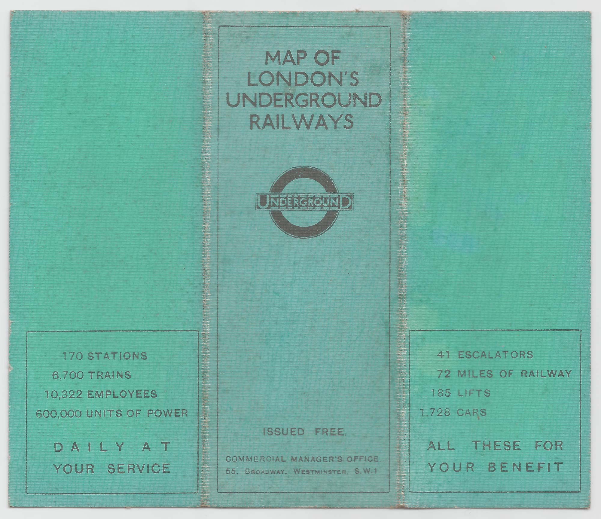
Printed by Waterlow and Sons, the orange cover has lists of Places of Interest and Theatres, with the nearest underground stations.
GARLAND 6.
Stock ID : 21498
SOLD
To see similar items click here

A pre-Beck map of the London Underground
STINGEMORE, Frederick H.
Underground Railways of London.
London: Commercial Manager's Office, London Underground, 1926. Colour-printed map on card, 125 x 150mm.
A little wear to edges and folds.
An early issue of Stingemore's pocket map of the London Underground, using his idea of expanding the central area of the map for ease of reading. On the map the Piccadilly Line only runs between Hammersmith & Finsbury Park and the Northern Line ended at Highgate (although this station is now Archway).
Among the 'lost' stations shown are 'Down Street' & 'Brompton Road' on the Piccadilly Line (both used as government shelters during WWII), 'British Museum' on the Central Line, and 'Praed Street' and 'Bishops Road', both of which have been incorporated into Paddington Station. 'Arsenal' is still called 'Gillespie Road'. The Central Line is coloured orange. The Thames is shown, returned after being omitted for the previous two years.
Published seven years before Beck this map had already dispensed with surface detail (including the Thames) and has the white-centred circles for interchanges.
Printed by Waterlow and Sons, the orange cover has lists of Places of Interest and Theatres, with the nearest underground stations.
GARLAND 6.
Stock ID : 21498
SOLD
To see similar items click here


Altea Antique Maps & Charts
Altea Gallery Ltd, 35 St George Street
London
W1S 2FN
United Kingdom
Tel: +44 20 7491 0010
info@alteagallery.com
Sitemap :

