
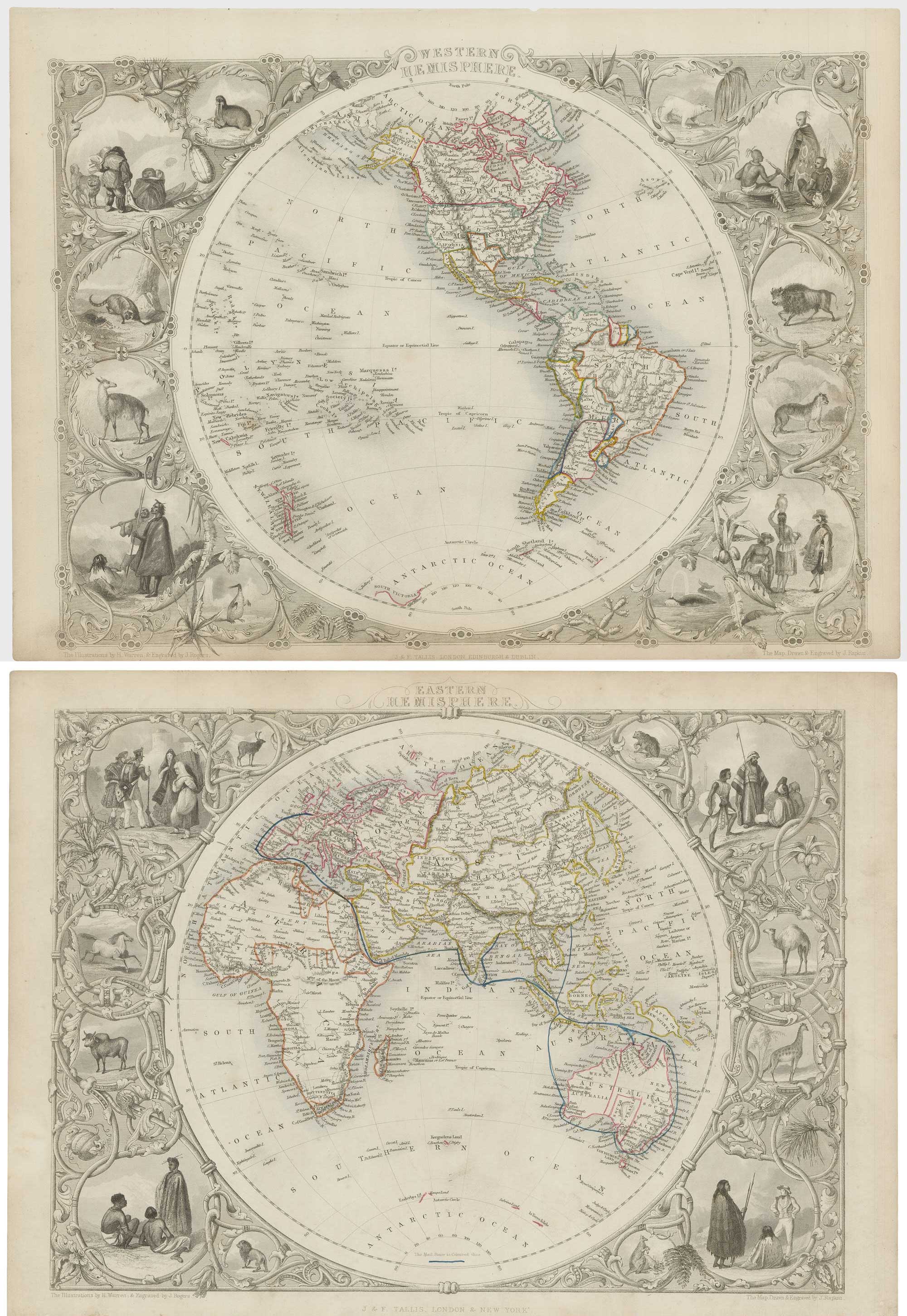
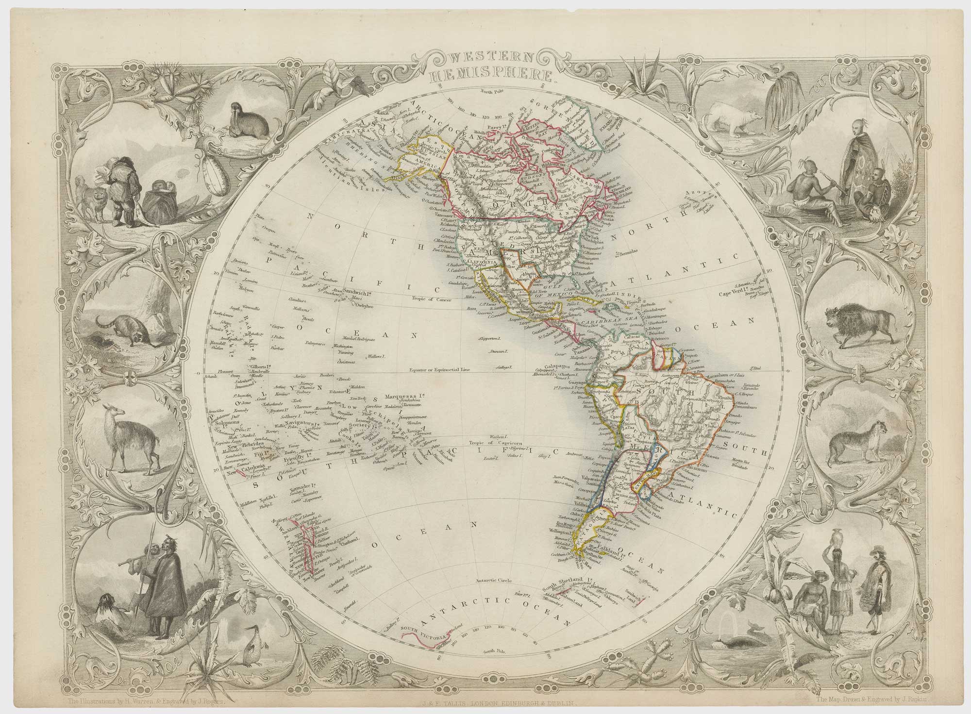
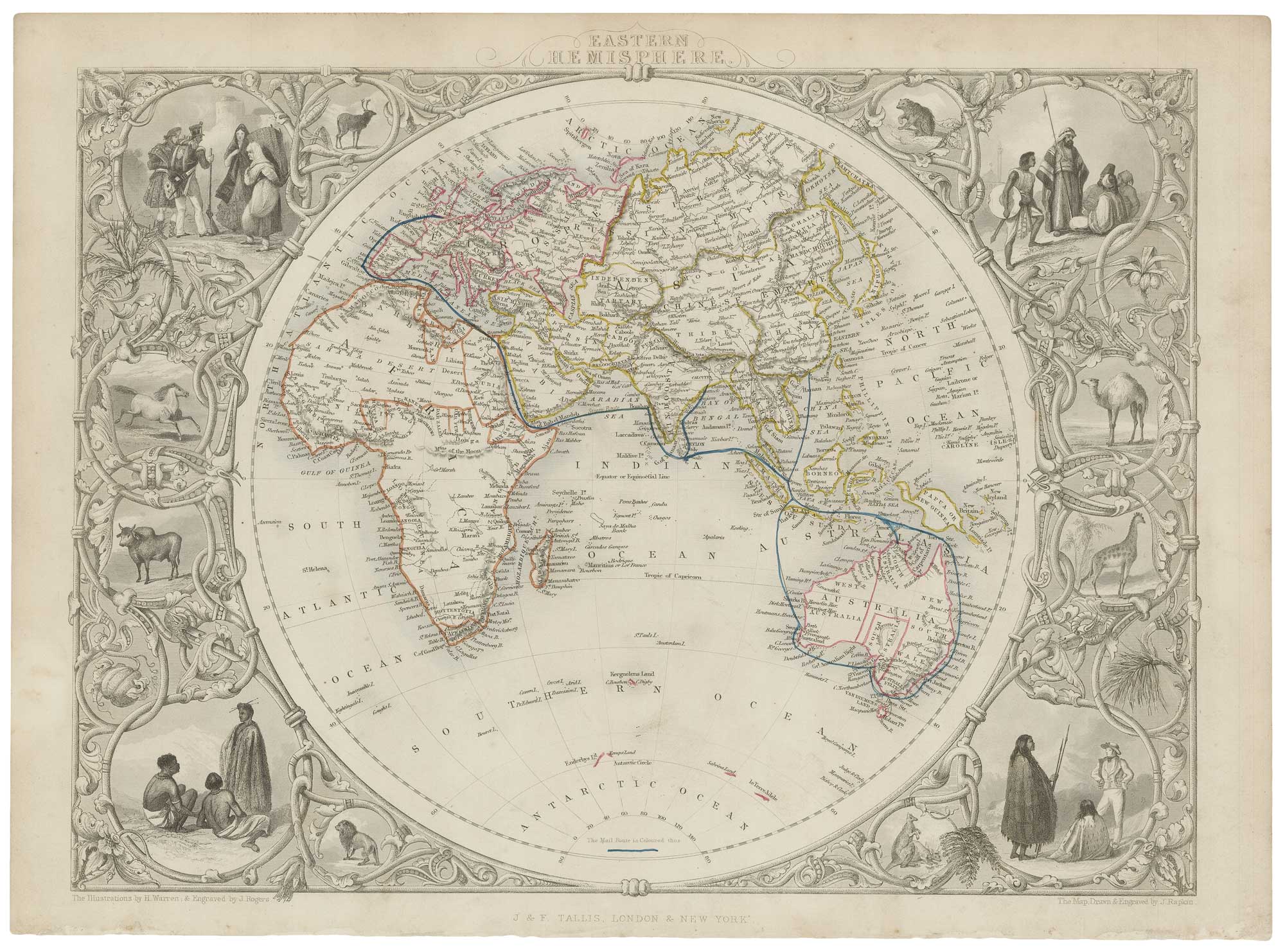
Pair of 19th century map of the world's hemispheres
TALLIS, John.
Western Hemisphere. [&] Eastern Hemisphere.
London, J. & F. Tallis, 1851. Original outline colour. Pair of steel engravings, each c. 260 x 350mm.
A little faint toning of edges.
A pair of maps of each hemisphere, both surrounded by decorative borders with vignettes of costumes and animals. Of particular interest is the mail route from England to Australia and Hong Kong marked on the eastern sheet.
The maps were drawn and engraved by John Rapkin for the 'The Illustrated Atlas, and Modern History of the World, Geographical Political, Commercial & Statistical', edited by Montgomery Martin, which was one of the last decorative atlases to be published.
Stock ID : 21572
SOLD
To see similar items click here


Altea Antique Maps & Charts
Altea Gallery Ltd, 35 St George Street
London
W1S 2FN
United Kingdom
Tel: +44 20 7491 0010
info@alteagallery.com
Sitemap :

