
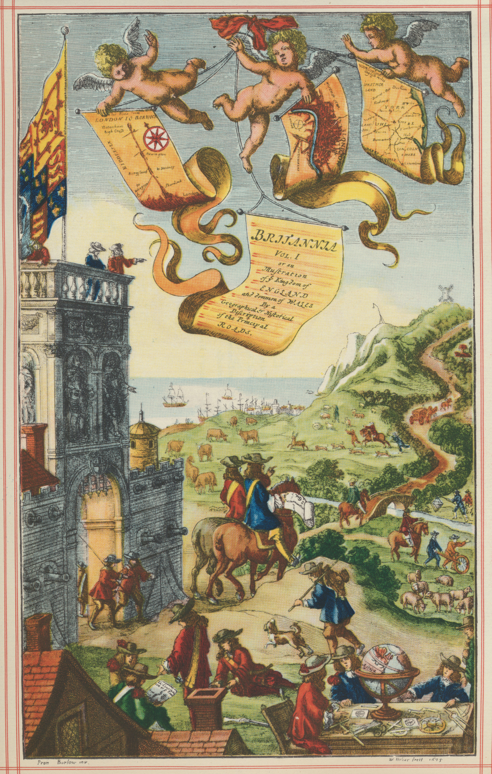
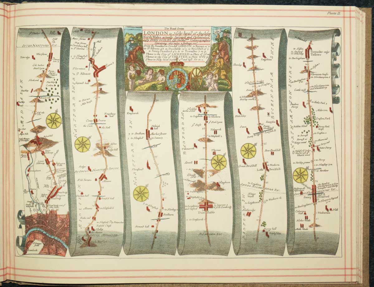
Facsimile of Ogilby's 'Britannia' road atlas
OGILBY, John.
Britannia Vol 1. or an Illustration of ye Kingdom of England and Dominion of Wales By a Geographical or Historica Description of the Principal Roads.
London: Alexander Duckham, 1939. Oblong 4to, original cloth gilt; descriptive label on front pastedown; pp. (7)+101 facsimile road maps.
Slight toning on front endpaper.
A facsimile of Europe's first printed road atlas, originally published 1675, with a general map and 100 plates of the roads of England and Wales, shown as strip maps on trompe l'oeil scrolls.
When Duckham's original copy of the Britannia came up at auction it was described as the only known example in contemporary colour.
Stock ID : 23868
£60
£60


Altea Antique Maps & Charts
Altea Gallery Ltd, 35 St George Street
London
W1S 2FN
United Kingdom
Tel: +44 20 7491 0010
info@alteagallery.com
Sitemap :

